Why Environmental Water Quality Management Must Move to Science-based, Real-Time Systems
Water quality monitoring in New Zealand needs to evolve to meet the challenges of sustainable land management. While traditional sampling methods provide valuable baseline data, they cannot capture the detailed patterns needed to understand ongoing environmental processes or optimise land use decisions. Real-time monitoring offers a pathway to science-based management that balances agricultural productivity with environmental stewardship.
1. Understanding Environmental Processes Through Continuous Data
Traditional water monitoring typically involves taking four to twelve samples per year from each testing site. This approach provides snapshots of water quality but cannot reveal the underlying processes that drive environmental change. Rivers, streams and aquifers respond continuously to rainfall patterns, seasonal variations, soil conditions, and land use practices, but periodic sampling captures only isolated moments in these dynamic systems.
The limitation becomes clear when considering how environmental degradation actually occurs. Rather than sudden pollution events, most water quality challenges result from ongoing processes: gradual soil erosion during rainfall, seasonal nutrient cycling, groundwater interactions with surface water, and cumulative effects of land management practices. Understanding these processes requires continuous data that reveals patterns over time.
Research demonstrates this gap clearly. Studies in Ireland and the UK found that traditional monitoring missed important seasonal patterns and underestimated annual nutrient loads by 30-50%. More significantly, periodic sampling could not identify the specific conditions that drove environmental impacts, making it difficult to design effective management responses.
Consider nutrient management as an example. Traditional sampling might detect elevated nitrate levels but cannot determine whether the source is surface runoff during specific weather conditions, groundwater contributions, or seasonal soil processes. Real-time monitoring reveals these patterns, enabling targeted management that addresses actual causes rather than symptoms.

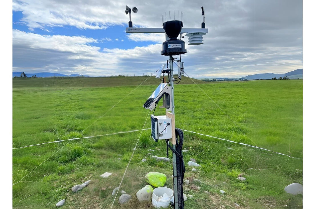
2. Real-Time Monitoring: Understanding Systems for Better Management
Modern sensor technology monitors water quality continuously, providing data that reveals environmental processes as they occur. This approach offers four key advantages for sustainable land management:
a. Process Understanding
Continuous data reveals how different land uses and management practices affect water quality under varying conditions. Farmers and land managers can observe the relationships between their decisions and environmental outcomes, supporting evidence-based optimisation of practices.
b. Source Identification
Real-time monitoring can distinguish between different pollution sources and pathways. This specificity is essential for targeting management interventions where they will be most effective, whether through riparian planting, wetland construction, or soil stabilization measures.
c. Seasonal and Climatic Patterns
Continuous monitoring reveals how environmental systems respond to seasonal changes, weather patterns, and longer-term climatic variations. This understanding supports adaptive management that responds to natural cycles and changing conditions.
d. Load Quantification
Traditional sampling often underestimates annual pollutant loads because it may miss periods of higher transport during storms or seasonal events. Continuous monitoring provides accurate load calculations that support proper sizing of mitigation measures like wetlands or treatment systems.
3. Optimising Environmental Investments Through Targeted Science
New Zealand invests substantial resources in environmental mitigation including riparian planting, wetland construction, erosion control, and sustainable farming infrastructure. Research consistently shows that strategic targeting of these investments can significantly increase environmental benefits for the same expenditure.
However, effective targeting requires detailed understanding of environmental processes that traditional monitoring cannot provide. Real-time monitoring enables evidence-based decisions about where and how to implement mitigation measures:
Riparian Planting: Continuous data identifies stream reaches where nutrient runoff is actually problematic and under what conditions. This allows riparian restoration to focus on areas where vegetation will intercept the highest pollutant loads rather than uniform planting that may have limited environmental benefit.
Wetland Construction: Real-time monitoring reveals pollutant transport patterns and seasonal variations that determine optimal wetland sizing and placement. Sensors can show which areas contribute the most nutrients during different seasons, supporting wetland designs that maximise treatment effectiveness.
Erosion Control: Continuous turbidity monitoring identifies unstable areas that contribute disproportionate sediment loads during rainfall events. This enables targeted soil stabilization efforts focused on the locations that will deliver the greatest sediment reduction benefits.
Infrastructure Timing: Real-time data reveals when environmental impacts actually occur, supporting targeted interventions during high-risk periods rather than blanket management restrictions that may be unnecessary most of the time.
The potential for improved effectiveness is substantial. Studies suggest that science-based targeting can increase environmental outcomes by 50-100% for the same investment. With significant annual spending on environmental measures, even modest improvements in targeting effectiveness could substantially increase environmental benefits.

4. Agricultural Optimisation Through Hydrological Understanding
Real-time monitoring provides farmers with detailed information about how their land interacts with water systems. This understanding supports optimisation decisions that can improve both productivity and environmental performance.
Surface Water Management: Continuous monitoring reveals how surface water moves across the landscape under different conditions. This information supports decisions about drainage, irrigation timing, and crop placement that optimise water use while minimizing environmental impacts.
Groundwater Interactions: Real-time monitoring can reveal connections between surface and groundwater systems that affect both water availability and quality. Understanding these interactions helps farmers optimise irrigation strategies and protect groundwater resources.
Vadose Zone: The vadose zone is the unsaturated layer between surface soil and groundwater that can act as a significant reservoir for excess nitrate leaching from farming practices . Nitrate accumulates here when it moves downward with water, meaning improvements at the surface may take years or decades to affect groundwater quality. This storage delays but does not prevent nitrate from eventually reaching groundwater, making it an important factor in long-term water management. Real-time measurement can identify longer term trends including nitrate movement from this zone.
Soil Health Assessment: Continuous monitoring of water quality parameters provides insights into soil health and nutrient cycling processes. This information supports precision agriculture approaches that optimise fertiliser timing and placement based on actual soil and environmental conditions.
Land Use Optimisation: Detailed understanding of hydrological patterns enables farmers to match land uses to the most appropriate areas. For example, continuous monitoring might reveal that certain areas consistently contribute more nutrients, suggesting they would be better suited for different crops or management practices.
5. Economic Benefits of Science-Based Management
The economic case for real-time monitoring is built on improved efficiency rather than crisis response. Several New Zealand communities face substantial costs related to water quality issues that could potentially be reduced through better understanding and management:
Selwyn District Council has allocated $5 million to investigate new wells and faces potential costs over $400 million for long-term solutions to elevated nitrate levels. Christchurch faces potential costs of $830 million to $1.5 billion for nitrate removal systems. These expenses reflect the costs of addressing cumulative environmental degradation over time.
Real-time monitoring systems, typically costing thousands to tens of thousands of dollars, could provide the understanding needed to prevent gradual degradation through targeted management rather than expensive treatment after problems develop. The situation also illustrates how costs are pushed downstream to communities and ratepayers with economic benefit in tax free capital gains and increased operational profits for private farm operators.
Importantly, real-time monitoring can optimise agricultural productivity by providing detailed understanding of environmental conditions. Farmers can make more informed decisions about irrigation, fertilizer application, and crop management that improve both economic and environmental outcomes.
6. International Examples of Science-Based Monitoring
Several countries demonstrate how real-time monitoring supports agricultural optimisation and environmental management:
Ireland operates continuous monitoring networks that have transformed understanding of agricultural impacts on water quality. The data supports both regulatory compliance and farmer decision-making by revealing specific relationships between practices and environmental outcomes.
England and Wales operate over 200 real-time monitoring sites that provide detailed information about catchment processes. This network supports both environmental protection and agricultural optimisation by revealing how different land uses perform under various conditions.
Iowa uses extensive real-time monitoring to understand agricultural nutrient cycling in the Mississippi River basin. The data supports precision agriculture approaches that maintain productivity while reducing environmental impacts.
Queensland monitors agricultural catchments draining to the Great Barrier Reef with real-time sensors that track both sediment and nutrient transport. This information supports targeted conservation practices that protect marine ecosystems while maintaining agricultural productivity.
These examples demonstrate that real-time monitoring can simultaneously support agricultural optimisation and environmental protection when applied with appropriate analytical frameworks.
7. Climate Adaptation Through Enhanced Understanding
Variable weather conditions require management systems that can adapt to changing circumstances. Real-time monitoring provides the detailed environmental information needed to understand how climate variability affects agricultural and environmental systems.
Continuous monitoring reveals how different weather patterns affect soil processes, water availability, and environmental transport pathways. This understanding supports adaptive management approaches that respond to seasonal conditions and longer-term climate trends.
The detailed environmental data from real-time monitoring also supports development of more sophisticated models that can predict system responses to different management scenarios under varying climate conditions.
For example, New Zealand's drought warning system is effective for monitoring surface drought conditions but has fundamental limitations that compromise the country's drought resilience. The system is currently not fully adequate when it comes to measuring aquifer (groundwater) levels and their role in drought resilience.
The primary drought indexes, such as the New Zealand Drought Index (NZDI), focus on rainfall, soil moisture, evapotranspiration, and surface indicators - but largely overlook underground aquifer storage and groundwater flows. This represents a critical blind spot because groundwater makes up over 80% of surface water flow in New Zealand, making aquifer health essential for drought resilience, especially during prolonged dry periods.

GNS Science stated: "Existing drought assessment tools have a high level of inaccuracy because they focus on soil and surface water and don't take into account the deep reservoir of connected groundwater that sustains freshwater systems."
Current assessment tools largely overlook the "deep reservoir" provided by aquifers, and New Zealand currently has few real-time tools to manage or forecast groundwater availability during drought. This gap becomes critical during extended drought periods when surface water sources dry up and communities become entirely dependent on groundwater resources.
Real-time groundwater monitoring networks could provide crucial early warning capabilities by tracking:
- Aquifer water levels and storage capacity
- Groundwater quality changes during drought stress
- The rate of aquifer depletion relative to recharge
- Saltwater intrusion in coastal aquifers during low-flow periods
- Temperature and chemical changes that indicate ecosystem stress

8. Implementation Strategy: Building Understanding Progressively
Real-time monitoring can be implemented systematically to build understanding over time:
Phase 1 - Assess: Install monitoring networks to characterise current environmental processes and identify relationships between land use and water quality outcomes.
Phase 2 - Analyse: Analyse continuous data to understand seasonal patterns, weather responses, and management impacts. Develop site-specific understanding of environmental processes.
Phase 3 - Optimise: Use process understanding to optimise land management practices and target environmental interventions. Implement changes while monitoring their effectiveness.
Phase 4 - Evolve: Establish ongoing monitoring to track long-term trends and adapt management strategies as conditions change.
9. The AI Revolution
The rapid development of artificial intelligence makes large water quality datasets increasingly valuable. AI tools can identify patterns in high-frequency data that would be impossible to detect manually. These insights are only going to get better and will revolutionise water management.
Real-time monitoring generates the large, high-quality datasets that AI systems need to function effectively. Traditional monitoring simply cannot provide enough data to support these advanced analytical approaches.
Advanced analytics platforms can transform raw sensor data into actionable intelligence through trend analysis, risk assessment, load calculations, and weather correlations. This moves water management from reactive responses to predictive, proactive strategies.
10. Supporting New Zealand's Agricultural Future
Real-time monitoring aligns with New Zealand's goals for sustainable agricultural development. The technology provides the detailed environmental understanding needed to optimise land use while meeting environmental standards.
This approach supports the development of precision agriculture systems that can maintain or increase productivity while demonstrating environmental stewardship through measured improvements in water quality outcomes.
There is also potential beyond the farm. The Israeli agritech sector is now valued at USD 13-15 billion with over 150 agritech startups. New Zealand's agritech sector is valued at approximately NZD 2.5 billion (about USD 1.5 billion). Real-time water monitoring could be a key technology driving this growth, helping farmers optimise their operations while protecting water quality. There is already a cluster of early stage sensor and software providers in this space. The right coordinated focus on science-based water management could create a position of global leadership with benefits to the broader economy.
Another important factor is the need to maximise investment in agricultural and environmental mitigation. New Zealand currently invests hundreds of millions to over a billion NZ dollars annually. Despite this substantial investment, several studies demonstrate that more precise, data-driven targeting can significantly increase the impact per dollar spent. Environmental mitigation investments are sometimes directed to sites with limited effect, while "hotspots" that could deliver the highest benefit may be missed. Smart targeting using mapping, digital monitoring, and prioritisation tools has been shown to double or triple the environmental benefits for the same spend.

There are also risks to New Zealand's farming future. From reputational damage reducing market returns to mandated land use changes, the impacts range from significant to catastrophic. Large-scale conversion of land from dairy farming back to other uses in New Zealand would result in significant economic costs. Dairy land typically holds 3 to 4 times the value of non-dairy pasture, so reverting use could reduce land asset values by around 60-70%. Additionally, conversion involves costly infrastructure removal and land redevelopment, adding millions in transition expenses. Since dairy farming generates substantially higher income and regional economic activity than other land uses, this shift would also reduce annual agricultural output and rural employment, with potential losses in the billions until new uses become productive. Overall, such a conversion would carry heavy economic impacts on land values, farm incomes, regional economies and the banking sector.
11. Overcoming the Challenges
Moving to real-time monitoring requires addressing several practical challenges:
Costs: While sensor systems require significant initial investment, the benefits often outweigh costs when considering avoided expenses for water treatment, ecosystem damage, and regulatory compliance. Sensor costs continue to decline as technology improves.
Technical Requirements: Modern sensors are much more reliable than earlier generations and require less maintenance. Automated cleaning systems and remote diagnostics reduce the need for field visits.
Data Management: Real-time monitoring produces large amounts of data that require sophisticated processing. However, new software tools and AI-based approaches are making data management much easier.
Regulatory Acceptance: Current regulations rely on traditional sampling methods. However, international experience shows that regulatory frameworks can successfully incorporate real-time data with appropriate quality standards.
Fragmented approach: There is a real risk that a haphazard approach to real-time monitoring will result in specific point solutions that will incur many of the costs but not all the benefits. For example, a site with a nitrate only sensor only since nitrate monitoring was the priority when a level sensor should also be included to help complete the ground water data picture for drought monitoring. Part of the solution is a centralised data solution that is accessible for different purposes.
Inertia: Change is hard. Regional councils, central government agencies and farm operators have many priorities. Developing turnkey, repeatable and proven approaches and processes that can be replicated easily can speed this change.
12. The Path Forward
New Zealand should take several steps to transition to real-time water monitoring:
Pilot Programs: Establish demonstration networks in key catchments to show the value of real-time monitoring. Focus on areas with intensive agriculture, urban development, or sensitive receiving environments. This stage is mostly complete with established pilots in all key regions.
Technology Development: Leverage existing New Zealand sensor providers and invest further in new sensor technology suited to New Zealand conditions. Partner with local companies to build technical capacity and create export opportunities. Consider an investment fund like AgriZeroNZ to support new technologies and startups while also investing new technologies from international startups. The data infrastructure with new software and AI tools to deliver measure, analyse and act capabilities. New and existing mitigation technologies and strategies need to be tested and turned into repeatable processes.
Regulatory Updates: Begin developing frameworks for incorporating real-time data into compliance assessments and environmental reporting.
Training Programs: Build technical capacity through training programs for technicians, data analysts, and environmental managers. There is also a need to develop training for teams implementing mitigation strategies. There is an existing large base of farm consultants who could do implementation and maintenance work with only a small amount of training.
Stakeholder Engagement: Demonstrate benefits to farmers, communities, and policymakers through pilot projects and education programs. This step is complete with quite advanced small scale programmes at farm and catchment levels demonstrating the impact that science-based water management can have. These pilots have also achieved good community engagement.
Conclusion: Science-Based Water Management
Real-time water quality monitoring provides the detailed environmental information needed for evidence-based land management decisions. Rather than relying on assumptions or periodic snapshots, continuous monitoring reveals actual environmental processes that can guide optimisation of both agricultural practices and conservation investments.

The technology enables a shift from reactive management to proactive optimisation based on understanding of how environmental systems actually function. This approach supports sustainable intensification of agriculture while demonstrating measurable environmental improvements.
Investment in real-time monitoring represents an opportunity to build the scientific foundation for sustainable land management that balances productivity with environmental stewardship. The detailed understanding gained through continuous monitoring supports more effective use of both agricultural and conservation resources.